Our Lab
A wide variety of cutting-edge tools to analyze ancient sites and technologies
Geography, Hydrology, Geology
Understanding the interaction between humans and their environment– See more
Satellite Imagery
By combining several tools and approaches including optical, Hyperspectral, Radar– See more
Egyptology
To better understand where we come from, we examine how past technologies and sites worked. –See more
CAD, 3D Creation
Understanding the interaction between humans and their environment.–
See more
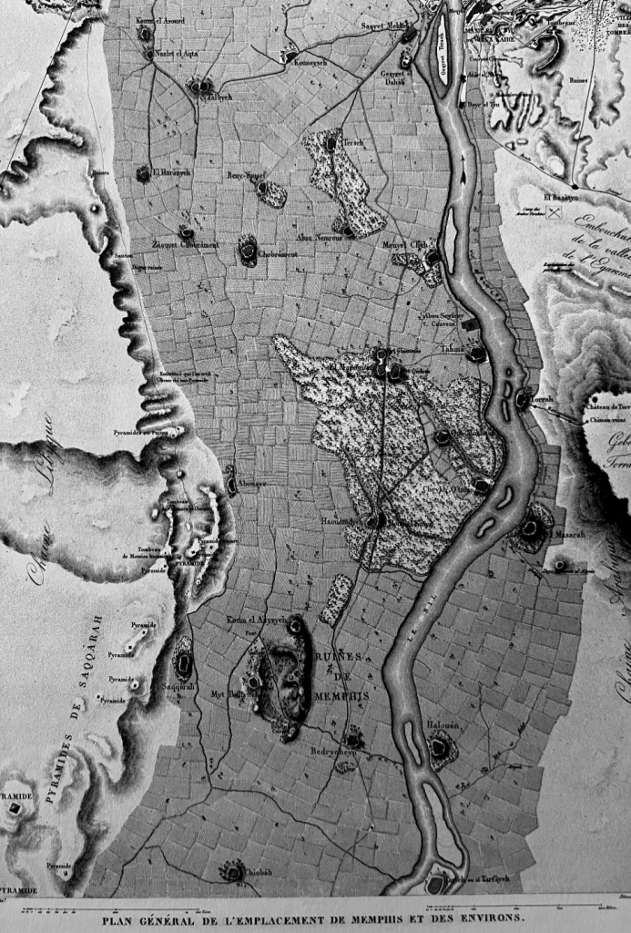
La description de l’Egypte, 1809
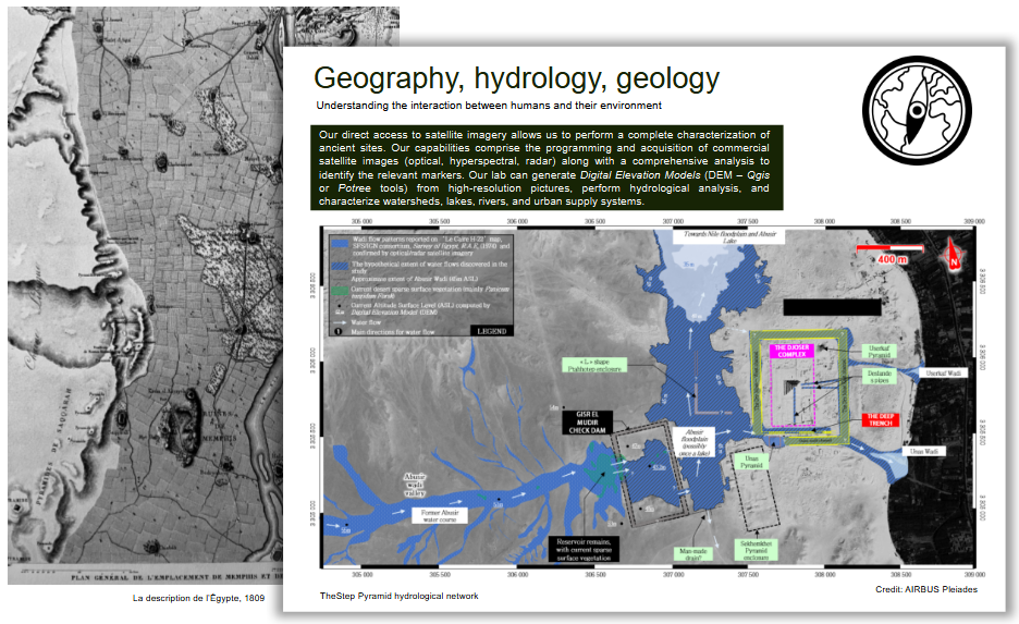
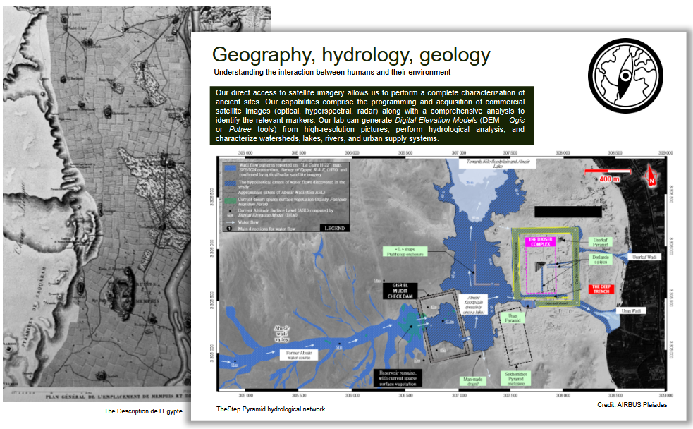
Geography, hydrology, geology
Understanding the interaction between humans and their environment
Our direct access to satellite imagery allows us to perform a complete characterization of ancient sites. Our capabilities comprise the programming and acquisition of commercial satellite images (optical, hyperspectral, radar) along with a comprehensive analysis to identify the relevant markers. Our lab can generate Digital Elevation Models (DEM – Qgis or Potree tools) from high-resolution pictures, perform hydrological analysis, and characterize watersheds, lakes, rivers, and urban supply systems.
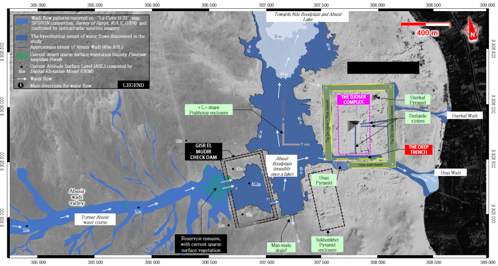

TheStep Pyramid hydrological network Credit: AIRBUS Pleiades
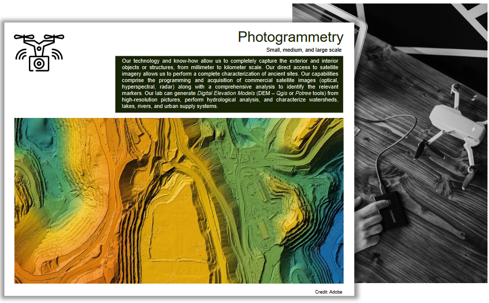

Photogrammetry
Small, medium, and large scale
Our technology and know-how allow us to completely capture the exterior and interior objects or structures, from millimeter to kilometer scale. Our direct access to satellite imagery allows us to perform a complete characterization of ancient sites. Our capabilities comprise the programming and acquisition of commercial satellite images (optical, hyperspectral, radar) along with a comprehensive analysis to identify the relevant markers. Our lab can generate Digital Elevation Models (DEM – Qgis or Potree tools) from high-resolution pictures, perform hydrological analysis, and characterize watersheds, lakes, rivers, and urban supply systems.
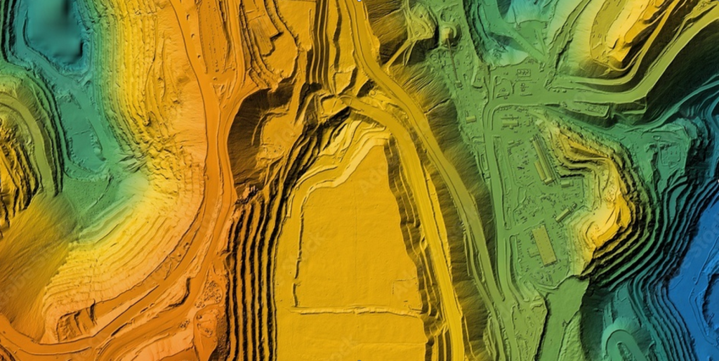

Credit: Adobe

Saqqara watershed – AIRBUS Pleiades
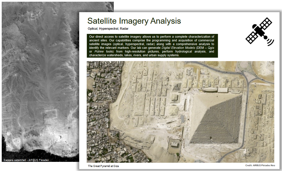
Satellite Imagery Analysis
Optical, Hyperspectral, Radar
Our direct access to satellite imagery allows us to perform a complete characterization of ancient sites. Our capabilities comprise the programming and acquisition of commercial satellite images (optical, hyperspectral, radar) along with a comprehensive analysis to identify the relevant markers. Our lab can generate Digital Elevation Models (DEM – Qgis or Potree tools) from high-resolution pictures, perform hydrological analysis, and characterize watersheds, lakes, rivers, and urban supply systems.
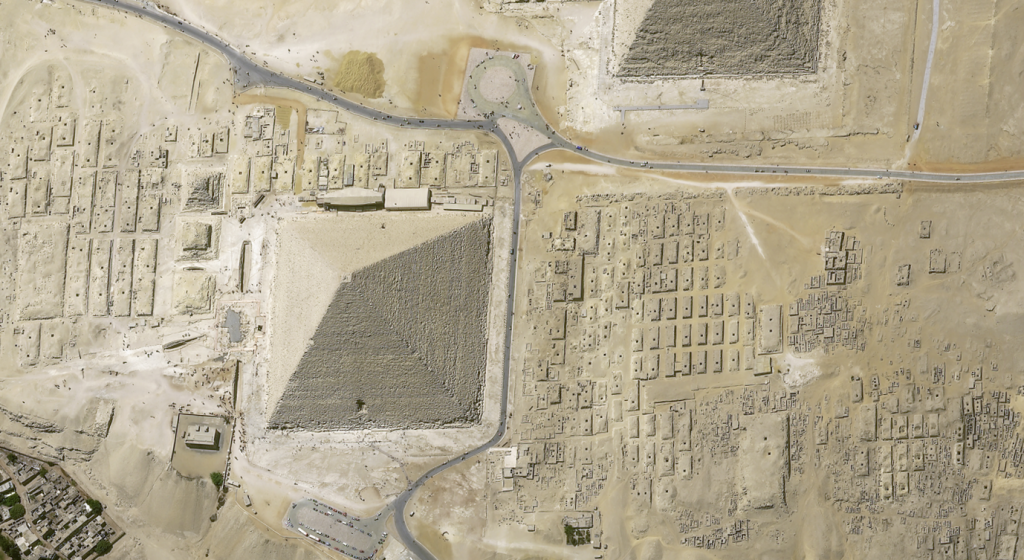

The Great Pyramid at Giza Credit: AIRBUS Pleiades Neo
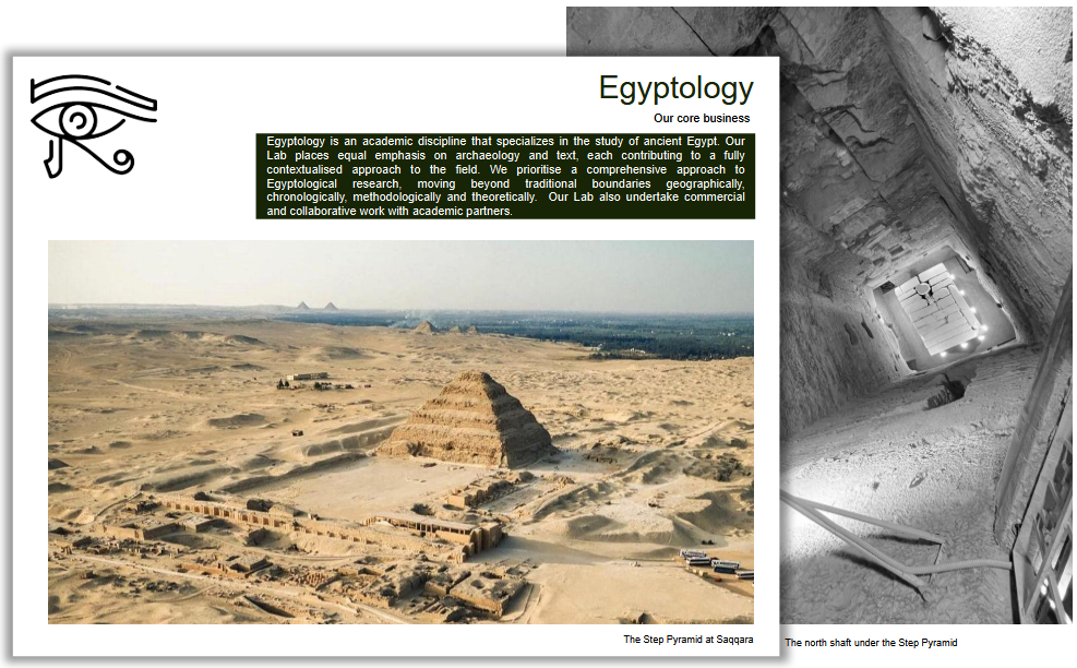
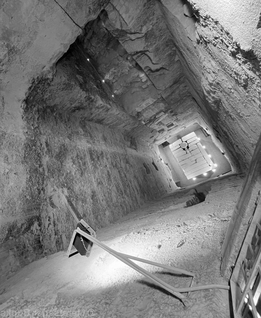
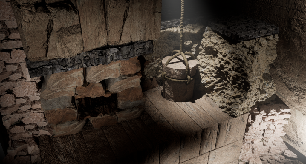
The north shaft under the Step Pyramid
Egyptology
Our core business
Egyptology is an academic discipline that specializes in the study of ancient Egypt. Our Lab places equal emphasis on archaeology and text, each contributing to a fully contextualised approach to the field. We prioritise a comprehensive approach to Egyptological research, moving beyond traditional boundaries geographically, chronologically, methodologically and theoretically. Our Lab also undertake commercial and collaborative work with academic partners.
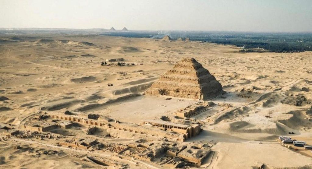

The Step Pyramid at Saqqara
The Djoser Tomb
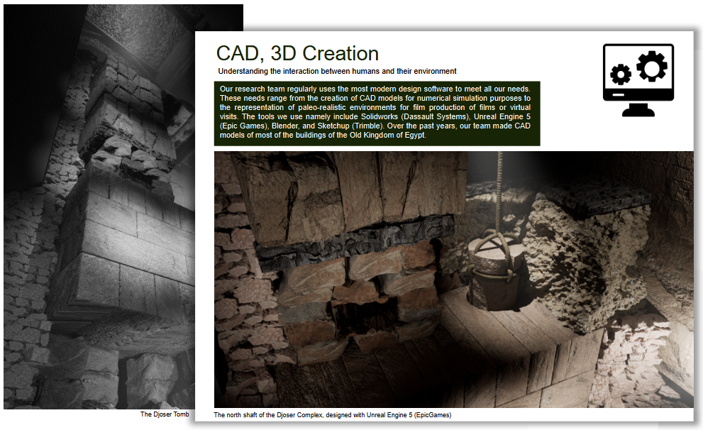
CAD, 3D Creation
Understanding the interaction between humans and their environment
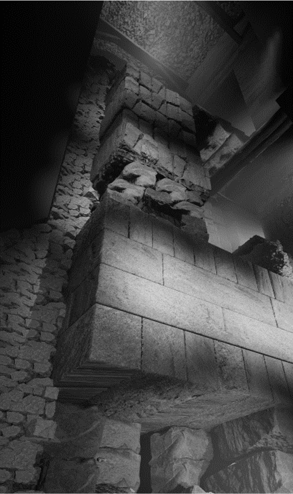
Our research team regularly uses the most modern design software to meet all our needs. These needs range from the creation of CAD models for numerical simulation purposes to the representation of paleo-realistic environments for film production of films or virtual visits. The tools we use namely include Solidworks (Dassault Systems), Unreal Engine 5 (Epic Games), Blender, and Sketchup (Trimble). Over the past years, our team made CAD models of most of the buildings of the Old Kingdom of Egypt.

The north shaft of the Djoser Complex, designed with Unreal Engine 5 (EpicGames)